Home
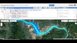
Trend analysis by Mann-Kendall test for precipitation using Google Earth Engine || 15 days training
Study Hacks-Institute of GIS & Remote Sensing
Streamed live on Sep 13, 2023
1,516 views
Air Quality Monitoring using Remote Sensing Techniques: O3, NO2, SO2, HCHO, CHOCHO and aerosols, CO
Monitoring Particulate Matter 2.5 (PM2.5) using Google Earth Engine || Air Quality Monitoring
Analyzes the long term trend of NDVI by Mann-Kendal's test using Google Earth Engine
Modeling AGBD GEDI L4B EarthEngine2
Geo for Good 2022: Time-Series Processing using Google Earth Engine
Full Course - Remote Sensing for Water Resources Application in Google Earth Engine
Calculating Rainfall Deviation - Part1 (Earth Engine Guided Project)
Google Earth Engine code for calculating NDWI from Sentinel 2 image collection | GEE online training
NASA ARSET: Google Earth Engine Basics and General Applications, Part 1/3
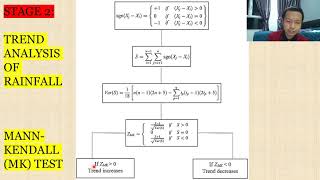
Trend Analysis of Rainfall in Temangan using Mann-Kendall & Sen's Slope
Google Earth Engine Tutorial-4: Drought Monitoring using MODIS VCI, TCI and VHI indices
Regression Analysis of Normalized Difference Vegetation Index to predict the NDVI Trend in GEE
Prepare future Land Use Change Prediction Map using Google Earth Engine part:1
NASA ARSET: Time Series Analysis and Change Detection in Google Earth Engine, Part 3/3
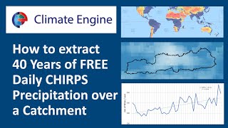
Climate Engine: Download FREE Daily CHIRPS precipitation data over a catchment (drainage basin)
Trend Analysis of Rainfall in Bentong using Mann-Kendall & Sen's Slope
Google Earth Engine: Estimate and map Crop sown area using Sentinel-2 Multi-Temporal data
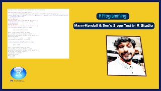
Mann-Kendall Trend & Sen's Slope Test in R Studio || R Programming || Statistics
Supervised Classification for Land Cover Mapping with Landsat 8 in Google Earth Engine