Home
Agisoft Metashape Tutorial Photogrammetry for drone mapping with Ground Control Points
Nexxis Tutorials
Mar 28, 2023
25,902 views
Agisoft Metashape - Complete Tutorial (Cloud, Mesh, DSM, DTM, Classify, Orthoimage - No GCPs)
Adding Metashape GCPs - Be Careful!
Pix4D Mapper Tutorial: Drone Image Processing with Ground Control Points
Agisoft Metashape Tutorial - Full Processing from photos to dense cloud - with Ground Control Points
3D Reshaper Software Tutorial: Multi-Layer Ground Points Extraction
UAV Drone Aerial Image Processing with GCP for GIS Data Generation in Agisoft Metashape
Which photogrammetry tool is the best ? (3DF Zephyr, Metashape, Reality Capture, Meshroom)
Agisoft Metashape orthophotomap processing workflow with GCPs
กระบวนการโฟโตแกรมเมตรีเชิงเลขจากข้อมูลภาพถ่ายทางอากาศ (Frame Camera) โดยโปรแกรม ERDAS imagine 2014
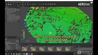
Converting DSM to DTM in Agisoft Metashape. Calculating Volume and Area in Agisoft Metashape.
Drones - The RIGHT way to Calculate Volumes with Agisoft Metashape
Agisoft Metashape - Tutorial (markers point cloud, mesh , texture)
ONE Trick to Improve Your Photogrammetry
Drone Mapping with a DJI mini 2 FOR FREE!
How to process drone images in Agisoft Metashape (photogrammetry survey)
3D modelling with the DJI Mini 3 pro (using photogrammetry)
Photogrammetry: Making a 3D model look good
How to Georeference Images in ArcGIS 10.8.1 - EASY Tutorial!
Agisoft Metashape tutorial (Basic workflow)