Home
How to Calculate Erosion & Accretion of a River for different time period using ArcGIS - part: 1
Study Hacks-Institute of GIS & Remote Sensing
สตรีมสดเมื่อวันที่ 7 ม.ค. 2024
การดู 1,706 ครั้ง
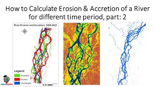
How to Calculate Erosion & Accretion of a River for different time period using ArcGIS - part: 2
How to generate NDVI Map of Sentinel satellite imagery with Python || Google Colab || Remote sensing
Chlorophyll-a Concentration Estimation on Google Earth Engine, and Export Images #GEE #Chlorophyll
River Stream Order Map in ArcGIS | ArcGIS Tutorial 28
Calculate Land Surface Temperature Using Google Earth Engine || Time Series Analysis || MODIS || LST
Flood Susceptibility Mapping using Google Earth Engine
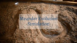
Meander Evolution Simulation
NDVI - Normalized Difference Vegetation Index || calculate NDVI using ArcGIS
Land use and Land cover Classification using Machine learning and Change detection
Flood Susceptibility Mapping using Google Earth Engine || Flood Hazard Mapping using GEE
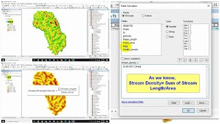
How to Calculate Stream or drainage Length and Density in ArcGIS
Download Village boundary shapefile of India I Survey of India - Official | Free | 2023
Air Quality Monitoring: Estimation of ground-level PM2.5 concentration using MODIS AOD
Supervised classification in Google Earth Engine || Land Use and Land Cover Classification
Convert NDVI raster to NDVI shapefile using ArcGIS
Identification of The Relationship Between LST And NDVI using Google Earth Engine
Estimating biomass using Google Earth Engine
how to calculate NDVI using ArcGis
Agricultural Drought Assessment in Using Vegetation Condition Index (VCI) in Google Earth Engine