Home
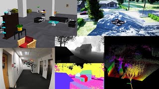
Autonomous Exploration Summary Video for Science Robotics Article
1 year ago
5:02
IROS 2022 Talk: FAR Planner: Fast, Attemptable Route Planner using Dynamic Visibility Update
1 year ago
10:05
Open-source: Aerial Navigation Development Environment
2 years ago
1:02
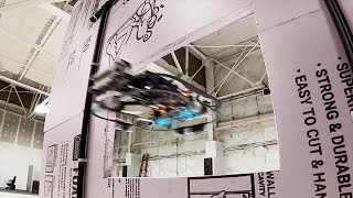
Flying Fast through Tight Passages and Avoiding Moving Obstacles
2 years ago
0:39
ICRA 2022 Talk: Autonomous Exploration Development Environment and the Planning Algorithms
2 years ago
4:00
Fast, Attemptable Path Planning in Unknown and Partially Known Environments
2 years ago
2:59
Autonomous Exploration — Dual-stage Viewpoint Planner
3 years ago
1:44
RSS 2021 Spotlight: TARE: A Hierarchical Framework for Efficiently Exploring Complex 3D Environments
3 years ago
4:52
ICRA 2021 Talk: Exploring Large and Complex Environments Fast and Efficiently
3 years ago
11:44
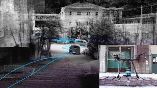
Autonomously Exploring and Mapping a Complex 3D Environment with an Aerial Vehicle
3 years ago
2:00
Open-source: Autonomous Exploration Development Environment
3 years ago
0:54
Autonomously Exploring and Mapping a Multi-storage Building with a Ground Vehicle
4 years ago
2:31
Autonomously Exploring and Mapping a 3D Large Environment with a Ground Vehicle
4 years ago
1:46
Autonomously Exploring and Mapping Three Large Buildings with a Ground Vehicle
4 years ago
1:33
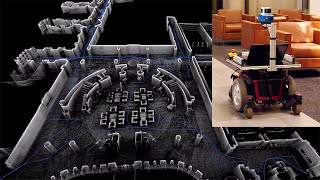
Autonomously Exploring and Mapping a Large Indoor Environment with a Ground Vehicle
4 years ago
1:34
Flying Outdoors and Indoors with Limited-sensing Aerial Autonomy
4 years ago
1:56
Flying in a Machine Shop with Limited-sensing Aerial Autonomy
4 years ago
2:11
Autonomous UAV with Smart Joystick and Way-point Following
4 years ago
1:53
Autonomous Ground Vehicle with Smart Joystick and Way-point Following
5 years ago
2:23
High-speed Autonomous Aerial Navigation through Trees
5 years ago
1:00
High-speed Autonomous Aerial Navigation through Quonset Hut
5 years ago
0:35
Pilot Guided Autonomous Flight over Orchard
5 years ago
1:41
High-speed Aerial Navigation and Obstacle Avoidance through Trees
6 years ago
3:14
Aerial Navigation and Obstacle Avoidance over Orchard
6 years ago
2:22
Aerial Navigation and Obstacle Avoidance on Industrial Site
6 years ago
1:31
Real-time Aerial and Ground-based Collaborative Mapping
7 years ago
1:26
GPS-denied Fast Autonomous Flight above and underneath Orchard Trees
7 years ago
2:21
GPS-denied Autonomous Flight through Tight Space underneath Shed
7 years ago
2:31
Online Mapping with a Kaarta Contour
8 years ago
1:46
Real-time Mapping with a Velodyne HDL-32E
9 years ago
2:02